Below freezing minimum temperatures recorded in Queensland not Winter yet
It was freezing! -5.7C in Oakey. This morning was very cold in many Queensland locations for not even being Winter yet. Check out my list for QLD. Regards, SEQ Scotty
It was freezing! -5.7C in Oakey. This morning was very cold in many Queensland locations for not even being Winter yet. Check out my list for QLD. Regards, SEQ Scotty
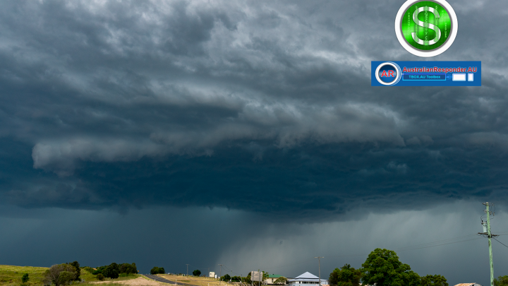
This severe thunderstorm sure had all the characteristics of a tornado producing supercell to the south & southwest of Boonah. There was lots of rotation and noticeable connection from cloud to the ground. I did get video of this supercell which I think clearly shows the supercell turned tornadic. Ill upload the video asap. If…
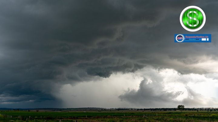
Photograph of the severe thunderstorm on 28th of November 2022 moving through SEQ. The sky turned green a number of times. Stay safe everyone. More wild weather on the way over the next week & into December 2022, January, February & March 2023. Regards, SEQ Scotty.
66mm in 1 hr at North Pine dam 55mm of it in 30 minutes to 2:55pm. tbox.au https://www.australianresponder.au/toolbox/geographics-australia/
Severe Supercell thunderstorm yesterday photographed from around the Clifton area in the darling downs & granite belt district of SEQ. This supercell was very powerful and structured very well it may have put down a few sporadic tornadoes. More photos uploaded soon.
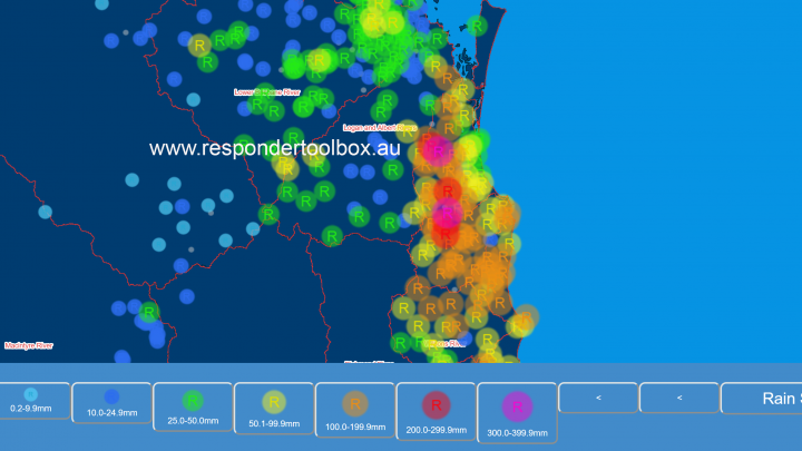
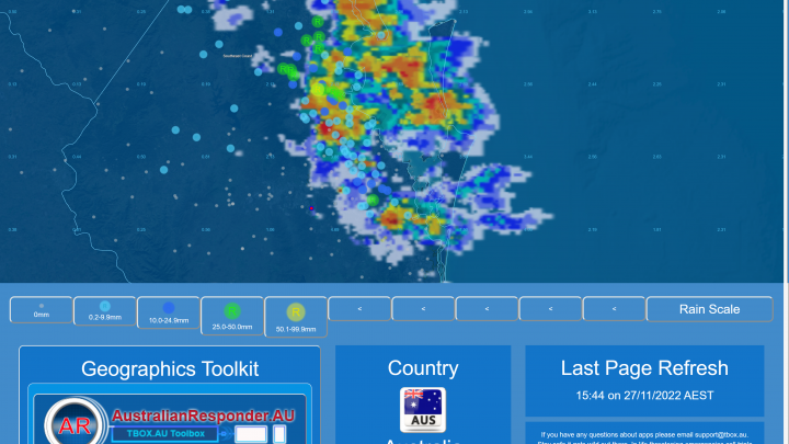
A trough and low pressure system have dumped massive amounts of rain on the Gold Coast & NE NSW with worst affected areas seeing 300mm+ in the 24hours to 9am this morning. Rain is continuing to fall in some areas. Please be careful on the roads. In comparison Brisbane has recorded falls around 30mm. Screenshot…
A trough is moving through this afternoon and evening. Some showers and thunderstorms are likely. Please keep a look out on the radar http://www.bom.gov.au/products/IDR662.loop.shtml
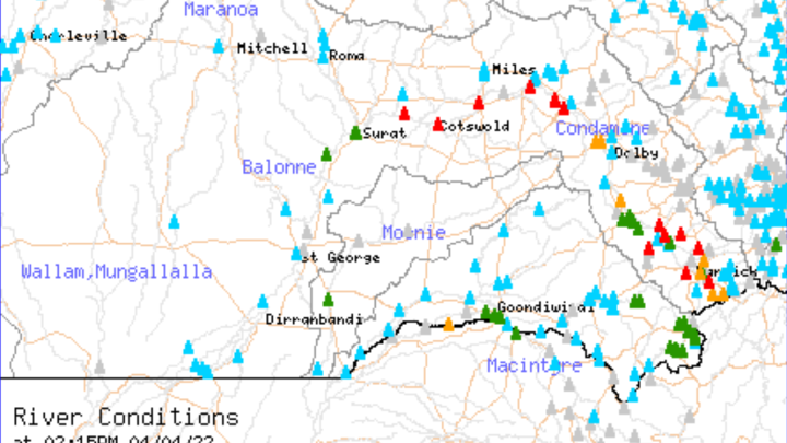
Significant rainfall has been received in the last 24 hours in the Condamine and Balonne River catchments. Further major Flood peaks are likely with Warwick expected to go into Major Flood by tonight.Flood Warning for the Condamine Balonne (bom.gov.au)
Significant rainfall has been received in the last 24 hours in Teviot Brook and Upper Logan River catchments. Major flooding is likely at Teviot Brook at Boonah this afternoon Monday 4th of April 2022.Flood Warning for Boonah & Surrounds (bom.gov.au)
There have been some very heavy falls recorded east of Warwick over the last 24hours from thunderstorm activity. Wilsons Peak recorded 128mm and Yangan 112mm of rainfall in the last 24 hours.